
Wald, Wein und Horizonte
March 25, 2023
by @jornfranke@trails.tchncs.de
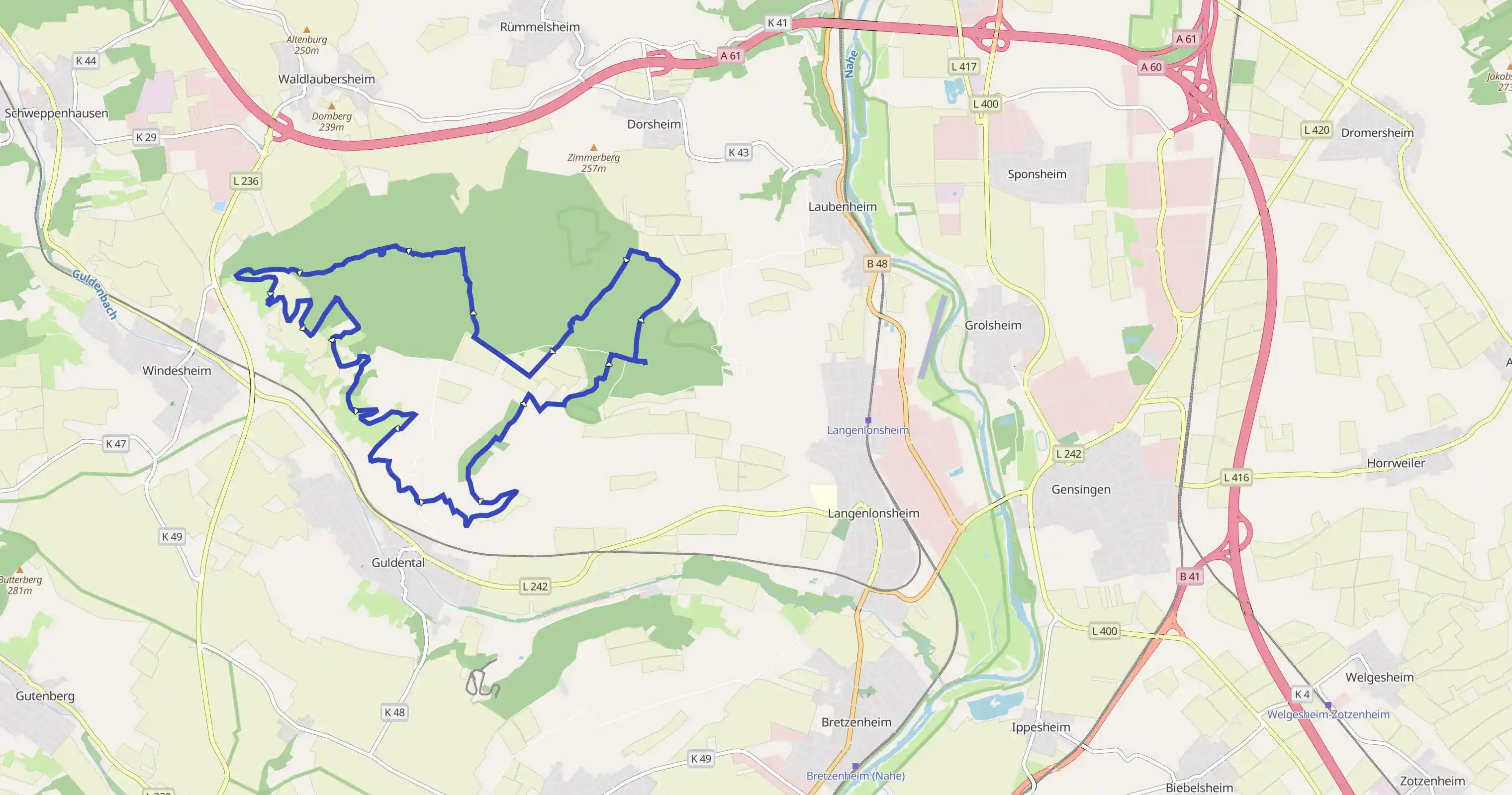
Langenlonsheim, Rheinland-Pfalz, Deutschland
Difficult
Distance 17.03 km
Est. duration 05h 04m
Elevation Gain 459 m
Elevation Loss 456 m
Category Hiking
Description
Route
Start

49.90632, 7.87277
21 m

49.90629, 7.87247
305 m

49.90806, 7.87144
488 m

49.90962, 7.87201
513 m

49.90981, 7.87223
703 m

49.91071, 7.87433
999 m

49.91291, 7.87649
999 m

49.91291, 7.87650
999 m

49.91292, 7.87649
1.28 km

49.91432, 7.87358
1.56 km

49.91476, 7.87053
1.82 km

49.91273, 7.86878
2.21 km

49.91013, 7.86537
2.27 km

49.90969, 7.86472
2.39 km

49.90943, 7.86344
2.66 km

49.90751, 7.86188
4.21 km

49.91289, 7.85070
4.73 km

49.91487, 7.84669
5.38 km

49.91506, 7.83944
6.23 km

49.91342, 7.82890
6.36 km

49.91357, 7.82709
6.49 km

49.91338, 7.82522
6.72 km

49.91311, 7.82255
6.72 km

49.91303, 7.82254
6.92 km

49.91278, 7.82514
7.36 km

49.91074, 7.82636
7.36 km

49.91067, 7.82627
7.36 km

49.91067, 7.82631
7.36 km

49.91069, 7.82639
7.75 km

49.90945, 7.82889
8.84 km

49.91116, 7.83469
10.32 km

49.90459, 7.83702
11.81 km

49.90067, 7.84135
12.13 km

49.89849, 7.83906
12.64 km

49.89637, 7.84346
13.67 km

49.89416, 7.85205
14.68 km

49.89713, 7.85089
14.79 km

49.89811, 7.85106
15.01 km

49.89954, 7.85310
16.49 km

49.90499, 7.86676
16.96 km

49.90645, 7.87100
16.98 km

49.90645, 7.87124
17.03 km
Finish